
Dubai is sketching a new pulse line across the city: the Metro Blue Line, revealed through its route map, is designed to stitch together expanding residential communities and business hubs with smoother interchanges and shorter journeys. A signature element is its planned crossing of the Dubai Creek on a dedicated metro bridge—part infrastructure, part city icon. Beyond the dots on the map, the promise is deeply practical: fewer detours, less time lost to traffic, and a network that keeps up with Dubai’s outward growth. For residents and investors alike, the Blue Line turns mobility into a sharper measure of location.
The platform doors hiss shut with that soft, decisive sound Dubai does so well. Cold air. Clean light. A train gliding in like it’s late for nothing. A commuter beside me, thumb hovering over a route-map screenshot, mutters: “If the Blue Line opens the way they say, I’m done with the double transfer.” He doesn’t sound excited. He sounds relieved—the kind of relief that comes from imagining your mornings getting your life back.
That’s the real story behind the Dubai Metro Blue Line. On paper, it’s a new line on a network diagram. In the city’s bloodstream, it’s a deliberate new current—meant to connect districts that have grown quickly, sometimes faster than the transport that serves them. The newly shared route map reads like a promise: close the gaps, improve the logic, make the daily commute feel less like a negotiation with traffic.
Dubai is famous for its scale. The roads are wide, the skylines keep moving outward, and “nearby” can mean a surprising number of minutes in a car. Over time, that distance reshapes habits: where people live, where they work, when they leave the house, whether they meet friends on a weekday or postpone everything to the weekend.
The Blue Line is planned as an answer to that sprawl. According to the published map, it adds new stations and new links intended to make cross-city movement simpler—especially between areas with rising residential density and employment clusters. The point isn’t only to add stops. It’s to reduce friction: better interchanges, clearer routes, and fewer journeys that feel like a zigzag across the city.
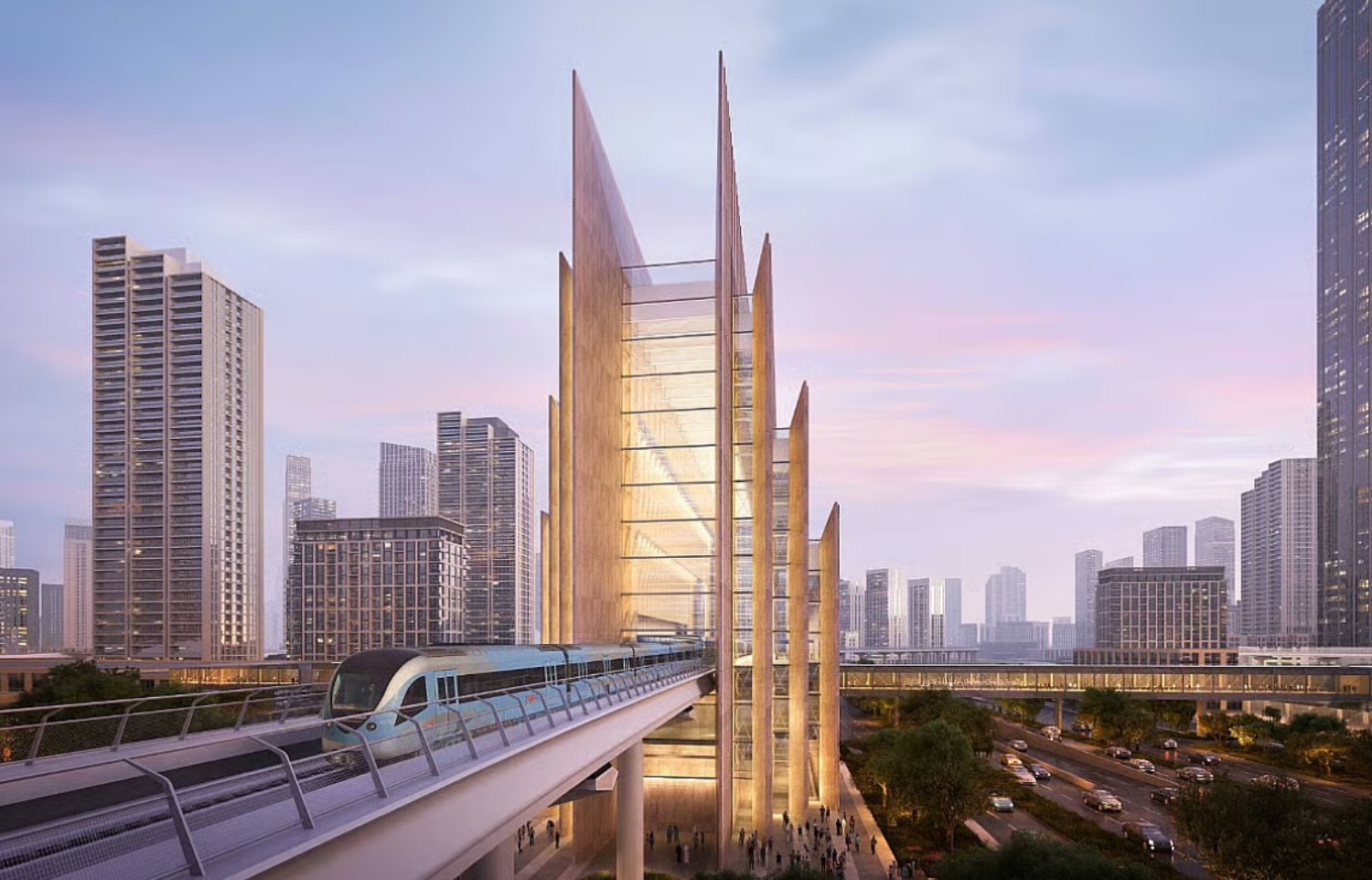
Then there’s the image that sticks: a metro bridge crossing the Dubai Creek. The Creek isn’t just water. It’s memory—abras, old warehouses, the birthplace of trading Dubai. To carry a metro line across it is to connect more than two banks. It’s to connect eras: the city that began at the Creek and the city that keeps reinventing itself beyond it.
You can almost picture the commute. A carriage full of people—suits, backpacks, school uniforms—sliding across the Creek while the sun turns the water into a sheet of metal. Someone lifts their phone for a quick photo. Someone else checks the time and smiles, because the journey is finally predictable.
Maps can look clinical, but the way people talk about them isn’t. A woman on the train—phone in one hand, tote bag in the other—zooms in on the route and says, half to herself: “This would change everything.” She points between two places that currently feel far apart because the journey isn’t direct. “School here. Work there. Every day.”
And that’s how a metro line becomes personal. A station isn’t only a station. It’s a new radius for your apartment search. It’s a better argument for taking a job across town. It’s the difference between arriving home drained, or arriving home still capable of living your evening.
Dubai has done this before. Each extension of the metro has quietly reorganised the city: foot traffic shifts, cafes fill at new times, streets around stations start to feel more walkable, more “used.” With the Blue Line, that effect is expected to ripple into communities that have relied heavily on cars and ride-hailing. The signal is clear: growth needs a backbone, and steel rails are one of the cleanest ways to provide it.
As the train pulls away, a voice from behind—young, upbeat—cuts through the calm: “Next time, we’ll take the new line.” It’s an offhand sentence. But in Dubai, offhand sentences have a habit of becoming construction sites, then infrastructure, then everyday life.
Metro projects in Dubai often reprice “distance” in a very literal way. When a station appears on a map, neighbourhoods can feel closer overnight—even before the first train runs. For buyers, landlords, and developers, the Blue Line corridor matters because:
In practical terms: if you’re evaluating property along the Blue Line’s influence zone, treat the route map as a starting point—then zoom in. The best-performing addresses are usually those where the station is not just “near,” but easy to reach, pleasant to walk to, and connected to daily life: groceries, schools, parks, and workplaces.